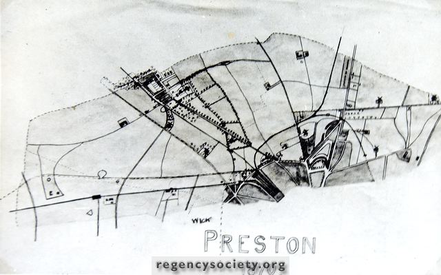
This photograph of an 1870 map shows no buildings north of Preston Circus. Note the tree lined road leading to Preston Village. Preston Manor and its grounds, now Preston Park, Preston Drove without houses, and the recently built villas in Harrington Road. Six windmills are shown. Those to the west of the railway line are Truseler’s Dyke Road Mill and Port Hall Mill. To the east can be seen Tower Mill, Ditchling Road, Hanover Mill, Bear Mill and Race Hill Mill.
Image Reference: JG_18_036.tif
Date: 1870
Image Details: Copy
Size of Original: 188x81
Place: Brighton
Additional Information: Drawings by JS Gray
The digitisation of this Volume was sponsored by The Preston Village Millenium Project and The Preston and Old Patcham Society
This image is copyright and is made available for personal study only. Commercial reproduction in any media is prohibited without written authorisation.
High resolution images for commercial use are available. Please contact The Regency Society