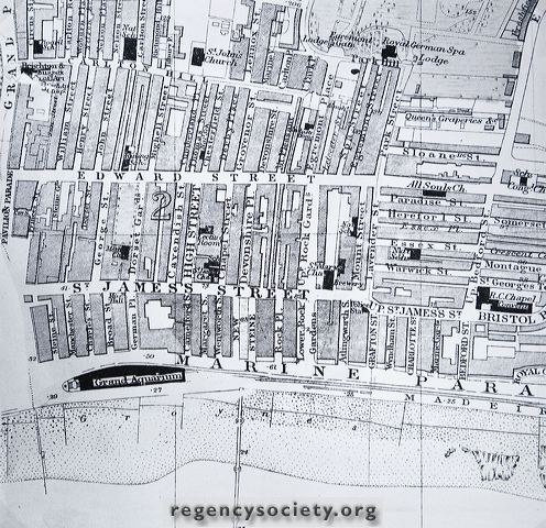
Photograph of a section of an Ordnance Survey Map of 1882 showing the Edward Street area. Note the very early slum clearance districts–the four streets above High Street, and those east of Devonshire Place, too congested even to be named.
Image Reference: JG_24_031.tif
Date: 1882
Image Details: Copy
Size of Original: 172x165
Place: Brighton
Additional Information: No comment
The digitisation of this Volume was sponsored by Duncan McNeill
This image is copyright and is made available for personal study only. Commercial reproduction in any media is prohibited without written authorisation.
High resolution images for commercial use are available. Please contact The Regency Society