This term is somewhat loosely applied to that dense area in Eastern Brighton bounded by Eastern Road, Lavender Street, Upper St James’s Street, Bristol Road and Montague Place.
In this confined space were built during the 1830s no less than 14 streets or passages, running east and west of Upper Bedford Street. Lavender Street, incidentally, took its name from double hedges of lavender, which grew on each side of the road in its early days.
The first clearance in this area took place in 1925 when Paradise Street and Manchester Row were completely swept away and the worst of the houses in Hereford Street were demolished and replaced by Council Houses. Essex Place and Essex Cottages were the next to go, in 1929. Crescent Cottages were dealt with in 1934 and partially rebuilt with new Council Houses. In the following year Laurel Row was entirely demolished and no trace of this narrow passage now remains. Finally most of Bedford Buildings went in 1937 though a few houses survived the War and stood until 1954.
If the Corporation’s plans are carried out several of the remaining streets, such as Essex Street and Somerset Street, will be demolished so that the area can be redeveloped as a single unit.
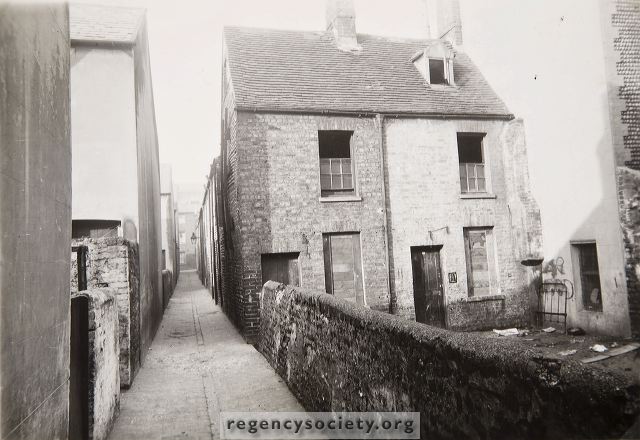
Laurel Row – This unlovely passage between Lavender Street and Upper Bedford Street gave access to no fewer than 40 houses, in various stages of decay. Victorian builders certainly had no inhibitions about the density of their houses. Removed under the terms of a slum clearance scheme in 1935.
Image Reference: JG_22_147.tif
Date: Undated.
Image Details: Original monochrome print
Size of Original: 150x104
Place: Brighton
Additional Information: No comment
The digitisation of this Volume was sponsored by Brighton Town Press
This image is copyright and is made available for personal study only. Commercial reproduction in any media is prohibited without written authorisation.
High resolution images for commercial use are available. Please contact The Regency Society