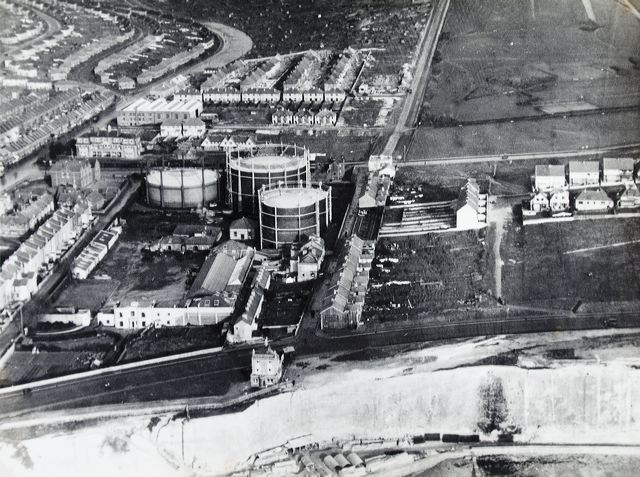
This photograph must have been taken soon after the construction of Marine Drive. To me the particular interest is that it affords a glimpse of Black Rock Cottages, just behind the Abergavenny Arms and facing the houses of Riflebutt Road. The road running to the left of the gasometres is Boundary Road, until 1928 the eastern boundary of Brighton Borough. The gas works were established here in 1823 just outside the Brighton boundary so as to avoid the duty which was then levied on all coal entering the town.
Below the cliff can be seen the works of the contractors engaged on the construction of the Undercliff Walk. Many of the massive blocks of the sea wall were made here.
Image Reference: JG_23_191.tif
Date: 1933
Image Details: Copy
Size of Original: 204x153
Place: Brighton
Additional Information: No comment
This image is copyright and is made available for personal study only. Commercial reproduction in any media is prohibited without written authorisation.
High resolution images for commercial use are available. Please contact The Regency Society