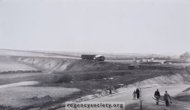
This photograph which dates from 1935 shows the narrow Hangleton Road dropping under the Dyke Railway bridge near the corner of Stapley Road. Only a few years previous, this was just a country lane much frequented by gypsies whose caravans stood in the pit in the foreground. The bridge was removed and the level of the railway raised by several feet about 1940, to facilitate Army movements during the War. About half way along the embankment can be seen the narrow arch, through which a cart track leading to Hangleton Farm. This track was on the site of the present West Way.
See next photograph for a view of the same area in 1957.
Image Reference: JG_37_079.tif
Date: 1935
Image Details: Copy
Size of Original: 240x140
Place: Hove
Additional Information: No comment
The digitisation of this Volume was sponsored by Ian Farrell, Chairman, Hangleton Harbinger
This image is copyright and is made available for personal study only. Commercial reproduction in any media is prohibited without written authorisation.
High resolution images for commercial use are available. Please contact The Regency Society