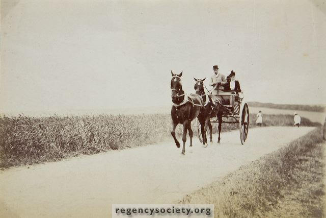
It is hard to realise that these two photographs were taken on what is now Neville Road. they show the old narrow lane, which ran from the top of Sackville Road to the hamlet of West Blatchington and thence by Toads Hole Road, to the Dyke Road.
In this photograph the trap is travelling south but the view is northwards towards the Three-Cornered Copse which is plainly seen on the hill beyond. The position of the trap is about opposite the top entrance to the Greyhound Stadium Car Park. On the left are the wheatfields of Court Farm, the land to the right of the road being part of J.J. Clark’s Goldstone Farm.
Both photographs were dated 25 July 1892. The road remained in the rural state for another 40 years, for it was not until 1932 that the present wide Nevill Road was constructed.
Image Reference: JG_36_002.tif
Date: 1892
Image Details: Original sepia toned monochrome print
Size of Original: 153x113
Place: Hove
Additional Information: No comment
The digitisation of this Volume was sponsored by The Friends of West Blatchington Mill
This image is copyright and is made available for personal study only. Commercial reproduction in any media is prohibited without written authorisation.
High resolution images for commercial use are available. Please contact The Regency Society